Alaska Sea Grant

Readings

Readings

Hypothetical spill
You will design their own spill type and location and model where the detritus will drift based on ocean currents. Modeling can take the form of a map on a poster with arrows indicating possible current directions and magnitudes and the resulting drift extent. Documentation on the poster justifying the locations of the currents can be used to demonstrate understanding.

What is it that spilled and what did it spill from?
Where was the spill located?
Is there a creative story behind the hypothetical spill?
What impact does the spill have on humans and other animals?
What features were considered regarding the drift extent of the spill?
What technology is used today to mitigate spill impacts in marine environments?

After you determine the type and location of the spill and find answers to the above questions, your group needs to create a presentation addressing the four points below. You will be assessed using the Ocean in Motion Project Rubric that will be provided to you.
Your presentation should address the following:

  • Which factors driving and directing currents (wind, tides, density (salinity/temperature) and topography) pertain to the spill? Why?
  • Were humans affected by currents, and if so, how?
  • How does the weather in the area of the spill affect the currents?
  • What technology pertains to studying the currents in the spill?

Background Information and Resources:

Oil and Chemical Spills

Nikes and Rubber Duckies

Rubber Ducky Journeys
Swept Away

Flip Flotsam video

Drifter Buoys

Hypothetical Landmass

Create a landmass of your own imagination with reference back to the earth science/geological concept of the supercontinent of Pangaea.

Draw a map of the landmass. Given the orientation of the landmass, create currents around the landmass using all of your understanding of what creates currents.
Is the landmass in the northern or southern hemisphere?
Are there any bays/inlets that might create significant tidal changes that would affect currents?
Is the rest of the planet water or are there other landmassess, ice caps, etc?
What seasons does the landmass have (keep in mind the tilt of the planet)?

After you create your landmass and determine answers to the above questions, your group needs to create a presentation addressing the four points below. You will be assessed using the Ocean in Motion Project Rubric. Your presentation should address the following:

  • Which factors driving and directing currents (wind, tides, density (salinity/temperature) and topography) pertain to the new landmass? Why?
  • Were humans affected by currents, and if so, how?
  • How does the weather in the area of the landmass affect the currents?
  • What technology pertains to studying the currents in the area of the landmass?

Resources

Pangaea Supercontinent

Pangaea: Wikipedia

Ocean Currents and The Distribution of Life

Coriolis Effect: Wikipedia

Coriolis Effect Animation

Wind Driven Surface Currents: Gyres Background

Surface Ocean Currents

Garbage Patch in the Pacific Ocean

Because of the subtropical gyre in the Pacific Ocean, circulation in the Pacific Ocean is very defined. In the middle of all gyres is located a calm area that is not under the influence of the currents. Debris and flotsam floating in the gyre often gets jettisoned into the middle area of no current after revolving around the gyre. There exists an accumulation of marine debris in the North Pacific subtropical gyre that continues to get bigger each year. Studies have been done on this area that delve into the atmospheric and ocean relationship; research has documented 6 pounds of plastic for every pound of plankton in this area (Moore, 2002).

What materials are accumulating in the gyre? Why?
What atmospheric circulation is responsible for the gyre?
How do general weather circulations in the subtropics aid the gyre and act not to mix the garbage patch out with the rest of the gyre?
What is the origin of most of the garbage? Ships? Land-based?
What technology has been used to study the garbage patch and determine the origination of much of the garbage?

After you investigate the garbage patch and the gyre and find answers to the above questions, your group needs to create a presentation addressing the four points below. You will be assessed using the Ocean in Motion Project Rubric provided to you.
Your presentation should address the following:

  • Which factors driving and directing currents (wind, tides, density (salinity/temperature) and topography) pertain to the garbage patch? Why?
  • Were humans affected by currents, and if so, how?
  • How does the weather in the area of the garbage patch affect the currents?
  • What technology pertains to studying the currents in the area of the garbage patch?

Resources:

Trashed: Across the Pacific Ocean, Plastics, Plastics, Everywhere

Why is the world’s biggest landfill in the Pacific Ocean?

Surface Ocean Currents

Wind Driven Surface Currents: Gyres Background

Plastics and Marine Debris video 6 min.
 
The Garbage Patch video

Gorilla in the Greenhouse: The Great Pacific Garbage Patch

Exxon Valdez Oil Spill

You will examine the specifics of the March 1989 Exxon Valdez oil spill that dumped nearly 11 million gallons of crude oil, the biggest spill ever in U.S. waters. This is a very relevant, real-world, local Alaskan story that portrays the importance of ocean currents, but it also addresses many other complicating facets of ocean currents that require you to use your conceptual understanding of how water moves in the ocean find where the oil went and why.

Why did the oil drift where it did?

Investigate and answer the following questions:
Does crude oil float on the surface or sink?
Which drivers of ocean currents played the largest role in determining where the spilled oil drifted?
How did information about currents in Prince William Sound inform the clean-up efforts?
How did the spill affect humans and other animals?

After you investigate the oil spill and find answers to the above questions, your group needs to create a presentation addressing the four points below. You will be assessed using the Ocean in Motion Project Rubric that will be provided to you.
Your presentation should address the following:

  •  Which factors driving and directing currents (wind, tides, density (salinity/temperature) and topography) pertain to the Exxon Valdez oil spill? Why?
  • Were humans affected by currents, and if so, how?
  • How does the weather in the area of the spill affect the currents?
  • What technology pertains to studying the currents in the Exxon Valdez oil spill?

Background Information and Resources:

Weather at the time of the spill and afterward:
The first three days after the Exxon Valdez oil spill afforded nearly ideal weather for oil recovery.

Prince William Sound is a small inland sea in that it is wide enough to have appreciable horizontal cyclonic circulation. It is also a fjord in that it has basin depths to 700 m but is stilled at 180 m to the open ocean. The general circulation pattern is defined by a portion of the westward flowing Alaska Coastal Current on the Gulf of Alaska shelf that enters Prince William Sound through Hinchinbrook Entrance and transits the sound from east to west before exiting through Montague Strait and rejoining the coastal current. However, there is much variability in this circulation, especially in the transport through Hinchinbrook Entrance.

More information on Prince William Sound’s circulation

Map showing Bligh Reef and the spill location

NOAA Fisheries Office of Exxon Valdez Oil Spill (EVOS) Damage Assessment and Restoration

Map of where the oil went

The behavior of the oil

Radio show about currents in Prince William Sound


Events and Announcements

Get Your Feet Wet

April 1 - May 31

Celebrate and share your local event with other Alaskan teachers and students! We'll send you and your students a certificate of accomplishment and place them on the Alaska Sea Grant honor roll if they complete a clean-up or other type of stewardship project. xx

Register here

Alaska Seas and Watersheds teaching resources and activity ideas for field trips and stewardship projects are available for all grade levels along with new NGSS-aligned lesson plans and units for field trips and the use of drones and submersibles to collect environmental data.

Coming Soon!

A collection of teaching resources for the Northern Gulf of Alaska Long-Term Ecological Research Project area and a link to resources for teaching about ocean acidification.

Professional Development

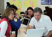
Alaska Sea Grant provides professional development in a variety of formats. Onsite in-service presentations and workshops are provided free-of-charge as an opportunity for Alaska K-8 teachers and informal educators to learn about our award-winning, Alaska-relevant curriculum materials and other educational resources.  Graduate-level courses can also be provided for the cost of Continuing Education Credits through the University of Alaska.

More information

Professional development
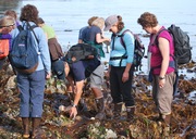
Tidepooling

Grants to Alaska Schools

Since its beginnings during the 2014–2015 school year, the Alaska Sea Grant school grant program has provided more than $100,000 to 10 Alaska school districts to increase local marine and aquatic education in 22 communities. The three-year, $10,000 grants have supported science curriculum revisions, development of NGSS-aligned lesson plans and units, field trip transportation, and the purchase of equipment and supplies.

If you are an Alaska teacher or administrator, contact us to get on the email list for the next announcement for a Request for Proposals.

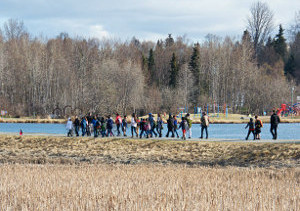
anchoragewetlandsStudents explore and collect data in Westchester Lagoon, the outlet to Chester Creek. Alaska Sea Grant funds support a watershed education field trip program for more than 250 Anchorage School District students.
 
Alaska Sea Grant University of Alaska Fairbanks Alaska Department of Education and Early Development NOAA

Photographs courtesy of Reid Brewer, Verena Gill, Heloise Chenelot, Stephen Trumble, and David Menke.

The contents of this website were developed with the assistance of Title II, Part B, Mathematics and Science Partnership Program federal funds from the Alaska Department of Education & Early Development. However, these contents do not necessarily represent the policy of the Department of Education & Early Development, and you should not assume endorsement by the Federal Government.

The University of Alaska Fairbanks is an AA/EO employer and educational institution and prohibits illegal discrimination against any individual: Learn more about UA's notice of nondiscrimination.

Help Using This Site
 

© 2007–2024 Alaska Sea Grant

The University of Alaska Fairbanks is an AA/EO employer and educational institution and prohibits illegal discrimination against any individual: Learn more about UA's notice of nondiscrimination.